TEREVUE
Category Archives: Knowledge Hub
10 Game-Changing Analytics for Modern Forestry and Land Stewardship
In the ever-evolving field of land and forestry management, the ability to analyze and interpret [...]
Oct
Policy Update: Two Major Legislative Wins for Wildfire Technology & Management
The wildfire management policy landscape is evolving rapidly with two recent significant legislative advancements at [...]
Oct
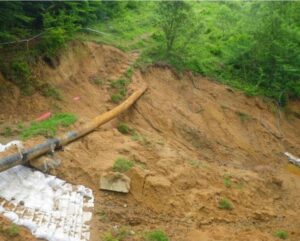
Slope Stability Explained, and It’s Relationship with Landslides
Have you ever wondered what makes a grassy hillside stay put instead of sliding down [...]
Aug
Fundamentals of Geospatial Data Science (for the Non-scientist)
The article lays out the basics of geospatial data for the non-scientist.
Jul
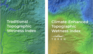
Elevating the Traditional Topographic Wetness Index with Teren’s Climate-Enhanced TWI
What is TWI? The Topographic Wetness Index (TWI) has long been a staple in modeling [...]
Jul
From Fire to Future: Using Spatial Analysis Tools for Wildfire Recovery in New Mexico
Wildfires: Balancing Prevention with Post-Fire Response With the ever-expanding 2024 wildfire season is off to [...]
Jul
AI and Data Science: 3 Emerging Trends to Solve Environmental Challenges
Discover how AI is revolutionizing data science. Learn how data analysis and insights from AI [...]
Jun
7 geologic hazards and their water-related triggers
Water is a powerful force that shapes our environment and influences a variety of geologic [...]
May
What is an Environmental Twin?
Teren's environmental twin platform is designed to deliver accurate digital replicas of changing environmental conditions. [...]
Nov
Coupling High-Fidelity Data & Hydrologic Modeling Expertise for Wetland Restoration
Teren’s high-fidelity data and modeling improved the wetland restoration process for mitigation compensatory bank permitting [...]
Aug
More than Vegetation Management: How One Pipeline Transmission Operator is Leveraging LiDAR to Protect Endangered Species
A case study to identify and prioritize areas for vegetation management and areas to be [...]
Jul
The Impact of Heavy Rain in an El Niño Year: Erosion, Flooding, and Infrastructure Risks in the Midwest
We’re evaluating how high rainfall in an El Niño year can lead to erosion, flooding, [...]
Jul
5 Hidden Costs of Bad Data in Renewable Development
From estimating earthworks to designing array layouts, LiDAR plays a crucial role in determining the [...]
May
How AI Can Help Solve Climate Change
Teren was featured in a recent article by Jerry Ledford in LifeWire about the power [...]
Oct
Pipeline Regulatory Compliance for External Threats & Extreme Weather
The Federal Register published the final part of PHMSA’s Gas Mega Rule. But don’t worry, [...]
Aug
Top 4 Analytics for Renewable Developers
Renewable developers are in a hard space. On the one hand, they are in a [...]
Jul
Satellite Data for Building Climate Resilient Assets
Toby Kraft was interviewed for a recent article by Geospatial World. He touched on Teren’s [...]
Jun
How an AI-Driven Approach to Analytics Is Changing the Geospatial Industry
Teren’s AI-driven approach to remotely-sensed data and analytics was featured in a recent article by [...]
Jun
PHMSA Advisory Bulletin: Climate Change, Earth Movement, and Other Geological Hazard
In response to recent events, PHMSA has released an Advisory Bulletin regarding the potential for damage to [...]
Jun
What You Need to Know about SEC’s Proposed Rules for Climate Change Disclosure
It’s Not All About Emissions The U.S. Securities and Exchange Commission (SEC) announced its proposed rules for [...]
Mar
- 1
- 2
